
Lake Edward and Lake George: The Twin Lakes of the Albertine Rift
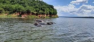
Lake Edward and Lake George are not just two lakes. They are a single, connected hydrological system — a pair of rift valley basins linked by a natural channel, sharing water, fish, and wildlife, and together forming the ecological heart of Uganda’s most visited savannah park. They sit in the Albertine Rift, the western arm of the East African Rift Valley, where the Somali Plate is slowly tearing away from the rest of the continent. This is the complete guide to the twin lakes of the Albertine Rift — their geography, their extraordinary biodiversity, their role in the Nile system, and everything you need to know before you visit. 🗺️ The Geography: Two Lakes, One System The two lakes sit within Queen Elizabeth National Park in western Uganda, occupying troughs in the Albertine Rift. They are fundamentally different in character, yet inseparable in function. Lake Edward is the larger of the two, and the more significant internationally. It covers approximately 2,325 square kilometres, making it one of Uganda’s largest freshwater lakes. It lies on the border between Uganda and the Democratic Republic of Congo, with only 29% of its surface area within Uganda and the remaining 71% in the DRC. The lake is 77 kilometres long and 40 kilometres wide, with an average depth of 34 metres and a maximum depth of 112 metres towards the Congolese shore. It sits at an elevation of approximately 920 metres above sea level. Lake George is the smaller sibling — a shallow, almost enclosed basin wholly located within Uganda. It covers just 250 square kilometres, with a mean depth of only 2.5 metres. It is a Ramsar Wetland of International Importance, designated in 1988 and covering approximately 15,000 hectares. 🌊 The Kazinga Channel: The Lifeline Between Them The two lakes are joined by the Kazinga Channel — a wide, natural waterway approximately 32 to 40 kilometres long that links Lake George in the east to Lake Edward in the west. The channel is not a river in the conventional sense. There is only about one metre of difference in altitude between the two lakes, giving the channel a largely lacustrine character — more a slow-moving extension of the lakes than a flowing river. The channel is the ecological heart of Queen Elizabeth National Park, roughly bisecting the park into northern and southern sectors. It holds one of the world’s largest concentrations of hippos, along with Nile crocodiles, buffalo, elephants, and an extraordinary array of birdlife. 🦛 Wildlife: A Concentration Unlike Any Other The twin lakes and the channel between them support one of the densest wildlife concentrations in East Africa. Hippopotamus. The Kazinga Channel is famous for its hippo population, which is among the largest in the world. Estimates for the channel and associated waters range from 1,600 individuals to over 2,000. During the 1960s, the hippo population in the vicinity of Lakes Edward and George was described as the most numerous in Africa. Other mammals. African elephants, buffalo, Uganda kob, waterbuck, and Nile crocodiles all depend on the lake margins and the channel as a primary water source. The surrounding savannahs and wetlands support over 100 mammal species. Birds. The lake system is a Key Biodiversity Area of global significance. Over 600 bird species have been recorded in Queen Elizabeth National Park, and the lakes and channel are particularly productive for waterbirds. Notable species include the African fish eagle, pied kingfisher, African skimmer, shoebill stork, great cormorant, African jacana, and pelicans. The Lake George Ramsar site specifically supports large mammals including elephants and hippopotamus, along with a rich wetland bird community. 🐟 The Fishery: A Lifeline Under Pressure The lakes and channel form a major source of fish for food and income, supporting thousands of fishing households across the region. The commercial fishery targets species including Nile tilapia, African catfish, semutundu, and marbled lungfish. Historical estimates placed the maximum sustainable yield at 7,000 tonnes on Lake Edward and 3,000 tonnes on Lake George, though more recent assessments have raised concerns about a collapse of the Lake Edward fishery and a drastic decline in productivity. The fishery is now at the centre of a bitter conflict between conservation and livelihoods. In 2026, the Ugandan government issued a directive limiting the number of boats at each landing site on Lakes Edward and George to just 33, part of efforts to curb overfishing. Fishing communities in Kasese District rejected the directive as “impractical and insensitive to their economic realities,” warning that it would push thousands out of work and potentially lead to “theft and smuggling”. The challenges are compounded by invasive water hyacinth, which has established itself in Lakes Edward, George, and the Kazinga Channel, and by the shared nature of Lake Edward, which complicates enforcement since the majority of the lake lies within the DRC. 🚤 The Visitor Experience: Boat Safaris on the Channel For travellers, the Kazinga Channel boat cruise is the single best way to experience the twin lakes. The two-hour cruise departs from the Mweya Peninsula and passes within metres of hippo pods, crocodiles basking on the banks, elephants drinking at the water’s edge, and an astonishing variety of birds. Cost: Foreign non-residents pay approximately USD $30 per person** for the standard two-hour cruise. Foreign residents pay **$25, and East African citizens pay UGX 30,000. Community-run cruises through Kazinga Channel Beach are also available at $30–$35 per person. A newer option is the MV Kazinga, a 65-seater boat launched on Lake Edward in 2026 and operated by Great Lakes Safaris, offering an additional way to explore the lakes and channel. Other activities include sport fishing for Nile perch and tilapia, canoeing on the channel, and visiting the fishing villages at Kasenyi, Katwe, and Katunguru, where artisan fishing communities live and work on the shores of the lakes. 💡 Practical Information for Your Visit Best Time to Visit: The dry seasons — June to September and December to February — offer the most comfortable conditions, with firm trails, clear skies, and excellent wildlife visibility. The wet seasons bring lush green landscapes and fewer visitors but can make some roads muddy. Where to Stay: Mweya Safari Lodge sits on the Mweya Peninsula overlooking the Kazinga Channel. Kyambura Gorge Lodge offers luxury bandas with views over the savannah and gorge. Budget options include Simba Safari Camp and Kasenyi Safari Camp. Getting There: Queen Elizabeth National Park is approximately 375 kilometres from Kampala — a 6 to 7 hour drive via Mbarara, or a short charter flight to Kasese Airstrip. The Kazinga Channel boat cruise departs from the Mweya Peninsula, accessible by
The Katonga River: The River That Changes Direction
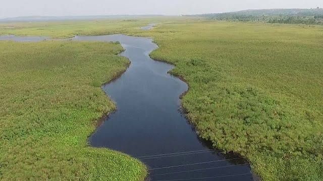
The Katonga River is one of Uganda’s most fascinating waterways—a river that, quite literally, changed its mind. It is a rare example of a “reversed river,” a watercourse whose flow direction was flipped by tectonic forces over millennia. Today, it is the centrepiece of one of Uganda’s least-visited and most intriguing wildlife reserves. 🗺️ The Geography of a Reversed River The Katonga River flows through southwestern Uganda, a region of rolling hills, wetlands, and savannah. Its story, however, is one of dramatic geological change. The Ancient Flow: Millions of years ago, the Katonga likely flowed westward, carrying water from the Lake Victoria basin into the Congo River system. The Great Reversal: The geological forces of the East African Rift Valley changed everything. A combination of downwarping of the Victoria Basin in the east and rift-flank uplift in the west created new drainage divides. This tectonic activity effectively “dammed” the old westward course, forcing the river to reverse direction. The Modern Course: Today, the Katonga’s flow is complex and variable. The main river now flows eastward, draining the Katonga Wildlife Reserve and emptying into Lake Victoria. From the western side of its watershed, however, water still flows southwest into Lake George. There are also connections to Lake Wamala to the north. It is this split personality—flowing both east and west from its central wetland—that makes the Katonga so unique. A Link to the Nile: The Katonga is part of the Nile basin. Its water, whether it flows directly to Lake Victoria or via Lake George and the Kazinga Channel, eventually joins the Victoria Nile, making its way to the Mediterranean. 🦌 The Katonga Wildlife Reserve: A Wetland Wilderness The Katonga River is the lifeblood of the Katonga Wildlife Reserve, a 207-square-kilometre protected area in the Kyenjojo and Kamwenge districts. Established in 1964 as a game reserve, it serves as a crucial corridor for wildlife moving between western Uganda and other regions. Wildlife Highlights: The Sitatunga: The reserve is best known for its viable population of the sitatunga, a rare, semi-aquatic antelope that lives in the papyrus swamps. Other Mammals: The reserve supports a high population of waterbucks (approximately 500), along with hippos, elephants, buffalo, bushbucks, reedbucks, warthogs, and various primates including black-and-white colobus monkeys and olive baboons. Birds: With a checklist of over 150 bird species, the reserve is a haven for birdwatchers, featuring wetland, savannah, and forest species. 🚶♂️ Exploring Katonga: On Foot and By Canoe What sets Katonga apart is its focus on low-impact, intimate exploration. There are no vehicle roads for game drives, so the park is best experienced on foot or from the water. Walking Safaris: This is the primary activity. Guided trails like the Kyeibale Trail and Kisharara Trail lead through savannah grasslands, riverine forests, and past unique rock formations. The reserve also offers a unique swamp walk, a guided trek through floating vegetation and shallow marshlands. Canoe Safaris: A canoe trip along the Katonga River is the reserve’s signature experience. Paddling silently through papyrus channels and open water offers an unparalleled opportunity to spot sitatungas, hippos, and river otters at eye level. ⚠️ Conservation Challenges The Katonga catchment faces significant environmental pressures. The river and its wetlands are vital for both wildlife and local communities, but they are under threat. Wetland Degradation: The Katonga catchment is under stress from rapid population growth and agriculture. Wetlands are being degraded through crop farming, brick making, and sand mining. Over 53% of the wetlands in the catchment are considered degraded. Pollution: Industrial runoff and poor waste management along the river contribute to water pollution, affecting its rich biodiversity. Invasive Species: Invasive plants like Lantana camara are outcompeting native flora and altering habitats for wildlife. Despite these challenges, the Katonga Catchment Management Plan and various conservation projects are working to restore degraded ecosystems and promote sustainable land management. 💡 Practical Information for Your Visit Location & Access: The reserve is approximately 235 km (5-6 hours’ drive) west of Kampala. The main signpost is at Kyegegwa along the Fort Portal route; from there, it’s a 42 km detour south to the reserve gate. Park Fees (2026): For foreign non-residents, the entry fee is approximately USD $35 per day. Best Time to Visit: The dry seasons (June to September and December to February) are ideal, as trails are firmer and the water level is lower, making wildlife viewing easier. What to Bring: Sturdy waterproof hiking boots, long trousers, a rain jacket, insect repellent, a hat, sunscreen, plenty of water, and binoculars for wildlife and birdwatching. 💎 The Verdict: A River of Wonders The Katonga River is more than just a body of water; it is a geological marvel and a haven for biodiversity. Its reversed flow is a testament to the powerful forces that have shaped the African continent. For travellers seeking an authentic, uncrowded, and deeply rewarding wilderness experience, the Katonga Wildlife Reserve offers a unique opportunity to explore a wetland paradise on foot and by canoe, encountering rare species like the sitatunga in a landscape that tells a story of deep time. If you’re drawn to the idea of exploring one of Uganda’s most unique and least-visited wilderness areas, I can help you plan the perfect itinerary. Contact TravelGiantUganda.com to arrange your visit to the Katonga Wildlife Reserve.
The Kagera River: Uganda’s Southern Boundary
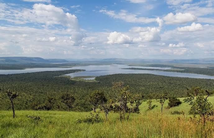
There is a river in southwestern Uganda that few travellers ever see, and yet it carries more water into Lake Victoria than any other — some 34% of the lake’s total river inflow. It is the furthest headstream of the Nile, the ultimate source of the longest river on Earth, and it forms the southern boundary of Uganda for a stretch before emptying into Lake Victoria near the Sango Bay floodplain. It is the Kagera River. And for all its hydrological significance, it remains one of the least-known and least-visited of Uganda’s major waterways. This is the complete guide to the Kagera River — its geography, its role as Uganda’s southern frontier, its extraordinary biodiversity, and why this quiet corner of the country deserves more attention than it receives. What Is the Kagera River? The Kagera River — also known as the Akagera or Alexandra Nile — is an East African river that forms part of the upper headwaters of the Nile. It is the largest single inflow into Lake Victoria, contributing approximately 6.4 billion cubic metres of water per year, or about 28 to 34% of the lake’s total river inflow. Its remotest source lies in the highlands of Burundi, near the northern tip of Lake Tanganyika, making it the furthest headstream of the White Nile. From there, it flows through Rwanda, Tanzania, and Uganda before emptying into Lake Victoria on Uganda’s southwestern shore. The river’s total length is approximately 600 to 800 kilometres, depending on how the source is measured. Its basin covers approximately 60,000 square kilometres, distributed among Burundi (22%), Rwanda (33%), Tanzania (35%), and Uganda (10%). The Course: From the Highlands to Lake Victoria The Source and the Headwaters The Kagera is formed by the confluence of two major tributaries: the Nyabarongo River, which rises in the highlands of Rwanda and drains approximately 16,000 square kilometres, and the Ruvubu River, which drains about 12,300 square kilometres in central and northern Burundi. These two rivers rise on the Congo-Nile Divide — the mountainous watershed that separates the Congo River basin from the Nile basin. The Nyabarongo discharges into Lake Rweru in southeastern Rwanda on the border with Burundi. Below Lake Rweru, the river is known as the Kagera. The Border River From Lake Rweru, the Kagera flows east along the Rwanda-Burundi and Rwanda-Tanzania borders to a confluence with the Ruvubu River. From there, it flows north along the Rwanda-Tanzania border, passing over the Rusumo Falls — a dramatic waterfall that marks the point where the three countries meet — and through Akagera National Park in Rwanda. The river then takes a turn to the east, following the Tanzania-Uganda border before emptying into Lake Victoria in Uganda. It forms parts of the Burundi–Tanzania, Rwanda–Tanzania, Burundi–Rwanda, and Tanzania–Uganda borders. The Lower Reaches and the Delta The lowest reaches of the Kagera flow through a lowland floodplain before entering Lake Victoria to the south of Sango Bay in Uganda. The river is joined on its left bank by the Kagitumba River, which drains 5,200 square kilometres of northeastern Rwanda and southern Uganda. At its mouth, the shore is relatively exposed, with sandy shores merging into papyrus swamp. The deposition of silt carried by the Kagera has led to the creation of a wide shallow belt with a sandbar at the river mouth. Uganda’s Southern Boundary: A Colonial Legacy The Arbitrary Frontier The Kagera River forms Uganda’s southern boundary for a stretch of its lower course — but it was not always intended to. In the late 19th and early 20th centuries, as European powers carved up Africa, the boundary between Uganda and German East Africa (modern-day Tanzania) was drawn not along the river, but along a straight line following the first parallel south. This arbitrary frontier — a mere straight line on the map — forms the chord to the wide southward-sweeping arc of the Kagera River. The river, which from Lake Victoria to Nsongezi is broad and navigable, was not adopted as the boundary line west of Lake Victoria. The result is a boundary that cuts across the river’s natural course, leaving sections of the Kagera flowing through Tanzanian territory while the boundary line runs parallel to it on land. The Kagera in Modern History The river has featured prominently in the histories of the countries it runs through. In 1894, German explorer Gustav Adolf von Götzen crossed the Kagera at Rusumo Falls, marking the beginning of Rwanda’s colonial era. In 1916, during World War I, Belgian forces defeated the Germans and entered Rwanda by the same route. In 1994, the Kagera gained international notoriety during the Rwandan genocide, when bodies of victims were carried by the river into Lake Victoria, causing a state of emergency to be declared in areas of Uganda where the bodies washed up. The Sango Bay–Minziro Transboundary Wetland A Biodiversity Hotspot The mouth of the Kagera River lies within the Sango Bay–Minziro transboundary wetland landscape, one of the most important biodiversity areas in East Africa. The Sango Bay area in Uganda comprises five separate Central Forest Reserves in Rakai District, dominated by swamp forests and inundated grasslands within the Kagera River floodplain. Across the border in Tanzania, the Minziro Nature Forest Reserve covers 257 square kilometres and contains the largest forested area in northwestern Tanzania. Together, Sango Bay and Minziro form a contiguous transboundary conservation site of global significance. The Wildlife of Sango Bay–Minziro The forests and wetlands of the Sango Bay–Minziro landscape are considered an outlier of the Guinea-Congo lowland forests otherwise found in the equatorial belt of Central and West Africa. This gives the area exceptional biodiversity value. Birds. Nearly 250 bird species have been recorded in Minziro, of which 96 are forest-dependent and 56 have only been seen in Minziro Nature Forest Reserve. The reserve supports populations of the globally vulnerable Blue Swallow and Papyrus Yellow Warbler, as well as the near-threatened Papyrus Gonolek. The Kagera’s papyrus beds harbour endemic species of the forest-savanna mosaic zone in the Lake Victoria Basin. Primates. The landscape offers habitat to a number of primates including the Grey-cheeked Mangabey and Thomas’s Dwarf Galago — neither of which has been recorded elsewhere in Tanzania — as well as the Red-Tailed Monkey and Angola Colobus. Mammals. The African Elephant is present as an occasional visitor from the adjacent Sango Bay Forest. Minziro is also the only site in Tanzania where the Western Tree Hyrax has been
The Semliki River: Uganda’s Wildest Frontier
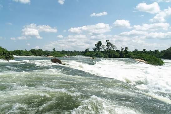
The Semliki River is one of Uganda’s most extraordinary natural features—a wild, meandering waterway that marks the border between Uganda and the Democratic Republic of Congo, flows past the snow-capped Rwenzori Mountains, and cuts through a valley teeming with wildlife. But what makes the Semliki truly unique is that it sits at the exact intersection of two of Africa’s greatest ecological zones: the dense lowland rainforests of the Congo Basin and the sweeping savannahs of East Africa. This collision of worlds creates a landscape of astonishing biodiversity—a place where forest elephants roam, chimpanzees call from the canopy, shoebill storks stalk the wetlands, and more than 440 bird species have been recorded. It is, by any measure, one of the most remote and least-visited wilderness regions in Uganda. And for adventurous travellers, it may just be the country’s best-kept safari secret. The Geography: Where the Semliki Flows The Semliki River is a major tributary of the Nile, approximately 140 to 230 kilometres long depending on the source. It flows north from Lake Edward—just south of the Equator in the Democratic Republic of Congo—to the southern end of Lake Albert. Along its course, it forms part of the international border between Uganda and the DRC, meandering through the Albertine Rift (Western Rift Valley) west of the Rwenzori Mountains. The river is fed by numerous tributaries from the Rwenzori Mountains, including glacier-fed torrents that carry snowmelt from the range’s rapidly disappearing glaciers. The Semliki discharges the surplus waters of Lake Edward, with a flow ranging from a minimum of 100 cubic metres per second to a maximum of 400 cubic metres per second. The river’s course is dramatic. Lake Edward sits nearly 300 metres higher in altitude than Lake Albert, and as the Semliki descends that height, it passes through many rapids and falls. The river finally empties into Lake Albert through a delta more than a mile wide, built up from silt carried downstream. The Semliki Valley: A Geological Crossroad The Semliki Valley is one of Uganda’s more remote wilderness regions, unspoilt by mass tourism and considered by many—especially avid birders—to be one of the country’s best-kept safari secrets. The valley encompasses two distinctive protected areas: Semuliki National Park and the Semliki Wildlife Reserve (formerly Toro-Semliki Wildlife Reserve). The valley’s geography is defined by its position in the Albertine Rift. Around seven million years ago, the entire valley lay submerged beneath a vast lake. Today, large portions of the low-lying park still flood during the rainy season, a reminder of that ancient inundation. The landscape is a study in contrasts. To the west rise the Blue Mountains of the DRC. To the east, the dramatic slopes of the Rift Valley escarpment. To the south, the glacier-tipped Rwenzori Mountains loom over the valley. And between them, the Semliki River threads its way north, creating a mosaic of habitats that is unmatched anywhere in East Africa. Ecology: Where Congo Meets East Africa Semuliki National Park: The Congo’s Easternmost Fringe Semuliki National Park protects the easternmost extension of the mighty Ituri Forest, which stretches more than 500 kilometres west to the Congo River. It is the only true tract of lowland tropical forest in East Africa—a fragment of the Congo Basin that reaches its eastern limit in Uganda. The park covers approximately 219 to 220 square kilometres and sits at altitudes ranging from 670 to 760 metres above sea level, making it the lowest-lying national park in Uganda. The landscape is dominated by Ugandan ironwood trees, interspersed with lush palm fronds and verdant ferns. This is a forest that has remained largely unchanged for millions of years. The lowland forests of Semuliki support at least 60 species of mammals, including forest elephants, buffalo, leopards, and 10 primate species including chimpanzees. The forest ecosystem strongly resembles that of lowland forests further west in the Congo Basin, and many species of this ecosystem reach their eastern limits in Semuliki. The Wildlife of Semuliki Mammals. The park is home to 53 recorded mammal species, including forest elephants—smaller and rounder-eared than their savanna cousins—forest buffalo, antelope species, baboons, and chimpanzees. Hippos and crocodiles are common along the Semuliki River. Recent genetic studies have revealed that chimpanzees in Semuliki National Park are genetically closer to populations in Toro-Semliki Wildlife Reserve and Itwara Forest Reserve than to those in Rwenzori National Park, highlighting the unique genetic heritage of this region’s primates. Birds. Semuliki is one of Uganda’s premier birding destinations. Over 441 bird species have been recorded—approximately 43% of Uganda’s total bird species. The park holds 35 Guinea-Congo forest biome species found nowhere else in Uganda, including the Spot-breasted Ibis, Hartlaub’s Duck, Congo Serpent Eagle, and Chestnut-flanked Goshawk. Species found only at Semuliki within Uganda include the Lyre-tailed Honeyguide, African Piculet, Yellow-throated Cuckoo, African Dwarf Kingfisher, Red-billed Dwarf Hornbill, Black-casqued Wattled Hornbill, Piping Hornbill, White-crested Hornbill, Banded Prinia, Leaf-love, Grey-throated Tit-Flycatcher, and Yellow-whiskered Greenbul. Many of these have very restricted Uganda ranges confined entirely to Semuliki’s lowland forest, meaning a missed sighting here is genuinely a missed sighting for the whole country. The park’s signature target for serious birders is the Nkulengu Rail—a strange, loud-calling forest rail heard far more often than seen, typically vocalising in duets at dawn and dusk near forest streams. Butterflies. The forest is alive with a kaleidoscope of over 350 butterfly species of every size and hue, fluttering between shafts of light. The Semliki Wildlife Reserve: Savannah and Swamp In contrast to the perpetual twilight of the national park, the Semliki Wildlife Reserve is a breath of light and air. Most of the reserve is a mosaic of dry savannah grassland, riparian woodland, and Borassus palms, with small patches of forest breaking up the open landscape. The reserve covers 548 square kilometres and was originally established as a game reserve in 1926, making it Uganda’s oldest wildlife reserve. It spans the Ntoroko and Kabarole districts, enjoying a dramatic Rift Valley setting between the Rwenzori Mountains, the Kijura escarpment, and Lake Albert. Wildlife. Herds of elephant, buffalo, and antelopes gather on the plains beneath the looming peaks of the Blue Mountains in the DRC and the Rift Valley escarpment to the east. Uganda kob are now commonly seen, along with reedbuck, waterbuck, bushbuck, and buffalo. The reserve also boasts over 462 bird species, making it a critical
The Nile Within Uganda: A Complete Journey from Source to Border
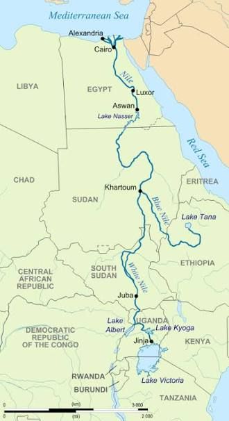
The Nile is the longest river on Earth. It stretches approximately 6,650 kilometres and flows through 11 countries, from the heart of Africa to the Mediterranean Sea. But every one of those kilometres begins in Uganda. The White Nile — the branch that carries the river’s life-giving waters through Sudan and Egypt — is born on the shores of Lake Victoria near Jinja, and it flows through Uganda for approximately 840 kilometres before crossing the border into South Sudan. This is the story of that journey. From the source to the border, through lakes and gorges, past waterfalls and wildlife, through the heart of a country that the river has shaped for millions of years. The Source: Where the Nile Begins The World’s Greatest Geographical Mystery For over 2,000 years, the source of the Nile was one of the world’s greatest mysteries. Greek astronomer Ptolemy described the river in 150 CE as flowing from twin lakes in the “Mountains of the Moon” — a description that proved remarkably prescient. Generations of traders, missionaries, and colonists tried to follow the river, but were halted by impassable swamps and cataracts. In the mid-19th century, it became an obsession for Victorian explorers vying to be the first to find its start. The answer was eventually found by John Hanning Speke, a British officer in the Indian Army who discovered Lake Victoria in 1858 and identified Ripon Falls, on the lake’s northern shore near Jinja, as the source of the Nile. Speke stood on the western banks of the river and looked down into the dark blue waters that begin their mighty flow over 6,000 kilometres to the Mediterranean. The geographic reality, as modern science has revealed, is more complex. The Nile is fed by a vast network of tributaries stretching deep into Rwanda and Burundi. But the point where the river leaves Lake Victoria remains the symbolic and hydrological start of the White Nile — and the place where Uganda’s claim to the world’s longest river begins. What Remains at the Source Today The original Ripon Falls were submerged in 1954 by the construction of the Nalubaale (Owen Falls) Dam, which flooded the narrow ravine and the falls themselves. A hand-painted marker from the old Ripon Falls remains as a tiny island in the lake near Jinja. Today, the Source of the Nile is one of Uganda’s most visited attractions. A 15-minute boat ride takes visitors out to the point where the Nile and Lake Victoria merge, where you can see the bubbles rising from deep below the surface — the visible sign of the river’s birth. There is a floating souvenir shop, a tiny platform for photographs, and monuments to both John Speke and Mahatma Gandhi. The site is undergoing a major redevelopment. Phase One, now at 98% completion and costing approximately UGX 15 billion, has delivered a modern pier, upgraded restaurants, improved washrooms, a glass viewing deck, and extensive beautification of the surrounding environment. Phase Two, projected at an additional UGX 26 billion, will add floating jetties, nature walkways along the riverbank, an amphitheatre, and improved road networks. The Victoria Nile: From Lake Victoria to Lake Albert The First 418 Kilometres The Victoria Nile is the 260-mile (418-kilometre) section of the White Nile that begins at the northern shore of Lake Victoria and ends at Lake Albert in northwestern Uganda. It is the stretch of river that most travellers encounter, and it contains some of Uganda’s most celebrated natural features. The river leaves Lake Victoria at Jinja, passing through the Nalubaale Dam before flowing north through a landscape of forests, farmland, and savannah. The upper section of the Victoria Nile has carved a shallow channel through the metamorphic rocks of the Buganda-Toro System, with few deposits of silt or alluvium — an indication of the channel’s geological youthfulness. North of the dam, the Victoria Nile has cut a shallow gorge that includes the Bujagali and Kyabirwa Falls. This section of the river is used for white-water rafting — one of the world’s premier destinations for the sport. Lake Kyoga: The River’s Midpoint About 70 miles (113 kilometres) north of Lake Victoria, the river widens and slows, becoming the large and shallow Lake Kyoga. This lake — which is fringed with swamps and less than 4 metres deep in most places — dominates central Uganda. Lake Kyoga receives water from eastern Uganda and from the Kafu River to the west. Extensions of the lake include Lake Kwania, Lake Bugondo, and Lake Opeta, which are surrounded by swampland during rainy seasons. When the river exits Lake Kyoga 50 miles (80 kilometres) northwest from its entry point, the Victoria Nile turns from an easterly direction to the north, northwest, and north again, before turning east toward Lake Albert. Murchison Falls: The River’s Most Dramatic Moment Between Lake Kyoga and Lake Albert, the Victoria Nile passes through a series of rapids and falls. The most striking is Murchison Falls — the point where the entire river is compressed through a gap just seven metres wide before plunging 43 metres in three stages into the gorge below. Discovered by explorers Samuel and Florence Baker but named after Roderick Murchison, president of the Royal Geographical Society, Murchison Falls is the centrepiece of Murchison Falls National Park — Uganda’s largest and oldest conservation area. The falls mark the final event in an 80-kilometre stretch of rapids that drains the last of the river’s energy, transforming it into a broad, placid stream that flows quietly across the rift valley floor into Lake Albert. The falls are located on the contact between the resistant granite-gneiss of the Uganda Gneiss Complex and the softer rift-related sediments of the Lake Albert basin. The Victoria Nile has carved a narrow gorge in the resistant rocks at the falls, beneath which it forms a wide channel within the softer sediments of the Albertine basin. The Nile Boat Cruise: The Best Way to Experience the Falls The three-hour boat cruise from Paraa to the base of Murchison Falls is widely considered the single best wildlife experience in Uganda. The cruise passes hundreds of hippos, enormous Nile crocodiles, elephants drinking at the water’s edge, and an extraordinary array of birdlife including the shoebill stork. The boat stops a few hundred metres short of the falls, and most operators offer the option to disembark at
The Rivers of Uganda: A Guide to the Country’s Waterways

Uganda is a country defined by water. Nearly one-fifth of its total area — some 44,000 square kilometres — is open water or swampland. Four of East Africa’s Great Lakes lie within its borders or along its edges, and the longest river on Earth begins its 6,650-kilometre journey to the Mediterranean from a quiet spot on the shores of Lake Victoria near Jinja. But Uganda’s rivers are more than geography. They are the lifeblood of its ecosystems, the engine of its economy, and the stage on which some of its most extraordinary wildlife spectacles play out. This is the complete guide to Uganda’s rivers — the waterways that shape the country, sustain its people, and offer some of the most rewarding experiences for travellers. The Nile: The River That Defines Uganda The Source of the Nile For centuries, the source of the Nile was one of the world’s greatest geographical mysteries. Greek astronomer Ptolemy described the river in 150 CE as flowing from twin lakes in the “Mountains of the Moon” — a description that proved remarkably prescient. It was not until the mid-19th century that the Victorian explorers finally identified Ripon Falls, on the northern shore of Lake Victoria near Jinja, as the source. Today, the source of the Nile is one of Uganda’s most visited attractions. Visitors can take a boat ride to the exact point where the river begins, see the bubbles rising from deep below the surface, and stand at the spot where the longest river in the world starts its journey north. The area has been developed with a modern pier, restaurants, a glass viewing deck, and monuments to both John Speke and Mahatma Gandhi. The Victoria Nile: From Lake Victoria to Lake Albert The Victoria Nile is the 260-mile (418-kilometre) section of the White Nile that begins at Lake Victoria and ends at Lake Albert in northwestern Uganda. It is the stretch of river that most travellers encounter, and it contains some of Uganda’s most celebrated natural features. The river leaves Lake Victoria at Jinja, passing through the Nalubaale (Owen Falls) Dam before flowing north through a landscape of forests, farmland, and savannah. About 70 miles north of Lake Victoria, it widens and slows, becoming the large, shallow Lake Kyoga. This lake — which is fringed with swamps and less than four metres deep in most places — dominates central Uganda and receives water from the Kafu River to the west. When the river exits Lake Kyoga, it turns north and northwest, passing through a series of rapids and falls before reaching Murchison Falls — the point where the entire Nile is compressed through a gap just seven metres wide before plunging 120 metres in three stages. The Victoria Nile then enters Lake Albert near its northern end, where the next section of the river begins. The Albert Nile: From Lake Albert to South Sudan The Albert Nile is the 130-mile (210-kilometre) section of the White Nile that flows from Lake Albert north to the border with South Sudan, where it becomes the Bahr el Jebel or Mountain Nile. It is navigable over its entire length, and a bridge crosses it at Pakwach, carrying the road between Gulu and Arua. The Albert Nile flows through the East Sudanian savanna — a hot, dry, wooded landscape composed mainly of Combretum and Terminalia shrub and tree species and tall elephant grass. Several smaller rivers flow into the Albert Nile, including the Ora and Zoka rivers, which drain the northwestern corner of Uganda — the region still popularly known as the West Nile. Uganda’s Other Major Rivers The Kagera River: The Nile’s Most Distant Source The Kagera River — also known as the Akagera or Alexandra Nile — is the most distant source of the Nile, carrying water from the highlands of Rwanda and Burundi across the borders of Tanzania and Uganda before emptying into Lake Victoria. It is estimated to contribute about 10% of the outflow from Lake Victoria into the Nile and is crucial for sustaining the river’s flow. The Kagera forms part of the border between Tanzania and Uganda, and its Ugandan stretch has been the subject of water quality studies that highlight the need for East African Community member states to mitigate riverine pollution. The Katonga River: The River That Flows West The Katonga River is one of Uganda’s most unusual waterways. It flows westward from Lake Victoria toward Lake George — the opposite direction to most of the country’s rivers. In southern and western Uganda, geological activity over centuries has shifted drainage patterns, and the land west of Lake Victoria is traversed by valleys that were once rivers carrying water into the Congo River system. The Katonga has an extensive catchment area of approximately 13,837 square kilometres, covering districts including Mubende, Mityana, Kalungu, Gomba, Sembabule, and Masaka. The river is known to experience flooding, and its waters are central to the Katonga Wildlife Reserve, a lesser-visited wetland reserve where sitatunga antelopes and other swamp-dwelling species can be found. The Semliki River: The Border River The Semliki River — sometimes spelled Semuliki — flows 143 miles (230 kilometres) north from Lake Edward to Lake Albert, forming part of the border between Uganda and the Democratic Republic of Congo. It is a tributary of the Nile and flows through the Albertine Rift (Western Rift Valley), draining parts of the DRC and forming a portion of the international boundary. The Semliki is the primary inflow into Lake Albert from the south, and it flows through the Semuliki National Park — Uganda’s only true lowland tropical rainforest — where the Sempaya Hot Springs bubble to the surface. The river’s banks have experienced erosion in recent years, raising concerns about the stability of the Uganda-DRC border. The Kafu River: The Western Tributary The Kafu River is located in western Uganda, starting from a swamp approximately 12 kilometres northeast of the village of Kitoma in Kibaale District. It flows eastwards at first, then turns north, and joins the Nkusi River before discharging into Lake Albert. The Kafu is one of the main rivers flowing into the Victoria Nile system, and it is an important water source for the districts of western Uganda. In recent years, the river has experienced drying patches during dry seasons, causing concern among communities that depend
The Hot Springs of Uganda: Where to Find Them and What They Mean

From the mist-shrouded forests of the west to the sun-baked plains of the north, Uganda is a land where the earth itself breathes. Hot springs are one of the country’s most fascinating and underrated natural wonders—places where boiling water bursts from the ground, steam curls through the trees, and communities have gathered for centuries seeking healing, spiritual connection, and the raw power of the planet beneath their feet. Uganda sits on the East African Rift Valley, a geologically active zone where the continent is slowly tearing apart. This tectonic activity heats underground water, which rises to the surface through faults and fractures in the rock, emerging as hot springs. The result is a network of geothermal sites scattered across the country—some famous and well-developed, others remote and barely known even to Ugandans. This is the complete guide to Uganda’s hot springs: where to find them, what they mean, and everything you need to know before you visit. Why Uganda’s Hot Springs Matter Uganda’s hot springs are not simply geological curiosities. They are living cultural sites, places where physical and spiritual healing converge. Across the country, communities believe these waters possess miraculous powers—the ability to cure skin diseases, relieve backaches, treat stomach ailments, and even restore fertility. Some springs are associated with ancestral spirits, and traditional leaders still perform rituals at their edges. They are also geothermal resources with enormous potential. The Ugandan government has earmarked several hot springs—including Kibiro, Panyimur, Buranga, and Katwe-Kikorongo—for cascaded development, exploring uses ranging from mineral extraction to tourism and eventually geothermal power generation. And they are tourist attractions in their own right, drawing visitors who come to witness water boiling at temperatures that can cook an egg in minutes, to bathe in mineral-rich pools, or simply to stand at the edge of a steaming vent and feel the heat of the earth rising through their boots. The Major Hot Springs of Uganda Uganda has seven notable hot springs, most of them concentrated in the Western Rift Valley. Each has its own character, temperature, and cultural story. Sempaya Hot Springs: The Most Famous Location: Semuliki National Park, Bundibugyo District Temperature: Female spring up to 106°C; male spring approximately 90°C Sempaya is Uganda’s most celebrated hot spring and the one most visitors encounter. It sits inside Semuliki National Park, in the heart of the Congo Basin rainforest, and consists of two distinct springs: the female spring (Nyansimbi) and the male spring (Bitente) . The female spring is the more dramatic of the two—a boiling geyser that shoots water up to two metres into the air, surrounded by smaller bubbling vents. The male spring is a large steaming pool lined with colourful algae, reached by a wooden boardwalk that winds through the wetland vegetation. For the Bamaga people, the springs are sacred. Annual ritual sacrifices are performed as part of ancestor worship, and a hut dedicated to these practices stands at the edge of the springs. Local legend tells of Bitente, a hunter who went into the forest and never returned, and his wife Nyansimbi, who followed in search of him—the two springs are believed to be their physical embodiments. A guided nature walk takes approximately one hour to visit both springs, passing through lowland forest bustling with primates and birds. Visitors can boil eggs and plantains directly in the hot water. Park Entry: USD $35 for foreign non-residents; USD $25 for foreign residents; UGX 15,000 for East African citizens. As of 2019, UWA scrapped additional fees for the guided walk to the springs. Kitagata Hot Springs: The Healing Waters Location: Sheema District, southwestern Uganda Temperature: Moderate to steaming, suitable for bathing Kitagata is Uganda’s most accessible hot spring for bathing. Located approximately two kilometres from Kitagata Town Council, it consists of two sites separated by the Ishaka–Kitagata–Kagamba road. The Mulago spring—named after Uganda’s national referral hospital—is the most popular, known for its body-friendly moderate temperature and believed to have healing powers. The Ekyomugabe spring was historically used by the King of Ankole. People come to Kitagata to bathe in the mineral-rich waters, seeking relief from skin diseases, stomach ailments, rheumatic disorders, and backaches. In recent years, the springs faced near-extinction as flooding and wetland destruction threatened their warmth, but a community-led committee formed in 2021 has successfully diverted floodwaters and restored access. Access: Approximately 2 kilometres from Kitagata trading centre, off the main road between Queen Elizabeth National Park and Lake Mburo National Park. Amuru Hot Springs: The Hidden Gem of the North Location: Amuru and Nwoya Districts, northern Uganda Temperature: Hot, but temperatures vary by season Amuru is one of Uganda’s most remote and least-visited hot springs. Located in Northern Uganda, it consists of two springs—one female (Wang Amuru) and one male (Wang Alero)—situated 1.5 kilometres apart. The springs are considered a National Cultural Site of Uganda. Local traditions require visitors to respect customs—including not taking anything from the site—to ensure the rains continue and the community prospers. Amuru is genuinely off the beaten path. One visitor described it as “a place only known by the locals. Totally undeveloped. Very quiet. Nicely shaded by trees. Can only be reached by a downhill Ugandan dirt road and path”. Efforts to develop the site for tourism are ongoing. Access: Near Gulu, approximately 5–6 hours from Kampala. Guided tours are available. Ihimba Hot Springs: The Bahima Springs Location: Kabale District, southwestern Uganda Temperature: Up to 120°C (248°F) Ihimba—also spelled Ihimbo—is named after the Bahima people who inhabit the area and use the springs for their healing properties. Located approximately 8 kilometres south of Kabale town along the Kabale–Katuna road, the springs are modestly sized but culturally significant. The water is rich in minerals, including lithium sulfate, and reaches temperatures of up to 120°C—among the hottest in Uganda. The springs are ranked second after Sempaya in terms of national significance but have faded in recent years due to delayed revamping efforts. Despite their state, Ihimba continues to attract people seeking supernatural healing from as far as Kampala, Bushenyi, Ntungamo, Kanungu, and Kasese. Rwagimba Hot Springs: “The Place of Being Carried” Location: Bunyangabu County, approximately 30 km southeast of Kasese Temperature: Up to 68.7°C Rwagimba’s name tells its story. In the local language, “Rwagimba” means “being carried”—a reference to patients who were carried to the springs, healed, and left walking unassisted. The springs are located at the bottom of a V-shaped valley, gushing from unconsolidated river deposits on both sides of the river. They are believed to have both physical and spiritual healing
Sempaya Hot Springs: Uganda’s Boiling Earth
The earth beneath your feet breathes. Steam curls up through the lowland forest canopy, carrying the scent of hot minerals. Somewhere ahead, past a boardwalk and a thicket of palms, water has been boiling up from deep below the Rift Valley for over 14 million years. This is the Sempaya Hot Springs — Uganda’s most dramatic geothermal wonder, and one of the country’s most unforgettable natural experiences. Hidden within the Congo Basin rainforest of Semuliki National Park, these two boiling springs are the result of the powerful subterranean forces that have been shaping the Albertine Rift since the continent began to tear apart. This is the complete guide to the Sempaya Hot Springs — what they are, where they are, how to visit, and why they belong on your Ugandan itinerary. Where Are the Sempaya Hot Springs? The Sempaya Hot Springs lie within Semuliki National Park in western Uganda, in Ntandi Town Council, Bundibugyo District. They sit between the northern foothills of the Rwenzori Mountains and the southern tip of Lake Albert, at an altitude of approximately 1,000 metres above sea level. The springs are located at the easternmost limit of the great Ituri Forest of the Congo Basin, making them part of one of the most biodiverse and geologically active regions in Africa. The Two Springs: Male and Female The Sempaya Hot Springs are not one attraction but two, and the distinction between them is both geological and cultural. The Female Spring: Nyansimbi The female hot spring, known locally as Nyansimbi, is the more dramatic of the two. It is a boiling geyser that shoots water up to two metres into the air, with temperatures reaching over 100°C — some sources record temperatures as high as 106°C. The geyser sits at the centre of a field of numerous smaller bubbling springs, each of them mineral-rich and boiling. The ground around the geyser is stained with mineral deposits, and the air is thick with steam, creating an otherworldly, almost primeval atmosphere. The Male Spring: Bitente The male hot spring, known as Bitente, is a giant, steamy hot pool approximately 12 metres wide, lined with colourful algae. It stands in a verdant clearing of swamp surrounded by palms and sweeping grass. The water here boils at approximately 90°C — cooler than the female spring, but still lethally hot. The male spring is reached by a wooden boardwalk that winds through the wetland vegetation, offering a safe and accessible viewing experience. The Names and the Legend The names Bitente and Nyansimbi come from a Bamaga folk tale. According to the legend, Bitente was a powerful hunter who went into the forest and never returned. After waiting for days, his wife Nyansimbi followed in search of him — and she too disappeared, near the spot where the geyser now boils. The springs are believed to be the physical embodiments of the two lost lovers — the male spring, calm and still; the female spring, explosive and restless. The Science: Why the Springs Boil The Sempaya Hot Springs are a product of the geothermal activity that heats underground water, causing it to rise to the surface through active fault lines in the Rift Valley. The water is heated by magma deep within the earth’s crust and forced upward along fractures in the rock. The springs bubble up from the depths to demonstrate the powerful subterranean forces that have been shaping the Rift Valley over the last 14 million years. A study of the springs’ geochemistry has shown that they contain high levels of sodium and carbonate, along with other dissolved minerals that have been absorbed from the volcanic rock through which the water passes. The Cultural Significance: A Sacred Bamaga Site For the Bamaga people, the Sempaya Hot Springs are far more than a geological curiosity. They are a sacred cultural site, intimately tied to the community’s heritage and spiritual practices. The Bamaga bring annual ritual sacrifices to the springs as part of their ancestor worship. A hut dedicated to these cultural practices stands along the edge of the hot springs, associating the pools with the ancestors and serving as a place for offerings and ceremonies. The springs are considered a living link between the Bamaga people and their ancestors — a place where the spiritual and natural worlds meet. The Visitor Experience: What to Expect The Guided Nature Walk Exploring the Sempaya Hot Springs requires a guided nature walk that begins at the Sempaya Visitor Centre. The walk takes approximately one hour for both springs, passing through a typical lowland forest structure dotted with palms, bustling with primates and a rich birdlist. The trail is flat and easy except for the humidity, but good walking shoes are essential because the area around the springs can be wet and muddy, especially during the rainy season. Boiling Eggs in the Earth One of the most popular experiences at Sempaya is the chance to boil eggs and plantains directly in the hot springs. Rangers demonstrate the heat by dropping raw eggs into the boiling water — they emerge fully cooked within five minutes. Visitors can participate in this tradition, lowering eggs or bananas into the steaming pools and retrieving them cooked by geothermal heat. It is a fun, interactive way to experience the raw power of the earth firsthand. The Boardwalk to the Male Spring The trail from the female spring continues west for about 30 minutes before reaching a wooden boardwalk that leads through the wetland vegetation to the male spring. The boardwalk offers a safe and accessible viewing platform, keeping visitors above the swampy ground while providing unobstructed views of the steaming pool. Practical Information: Visiting the Sempaya Hot Springs Entry Fees (2026) Visitor Category Fee Foreign Non-Residents USD $35 per person Foreign Residents USD $25 per person East African Citizens UGX 15,000 per person Source: Uganda Wildlife Authority 2026 tariff A guide fee of approximately USD $5 covers the short trail to the springs. Note: In 2026, the Uganda Wildlife Authority stopped charging additional fees for the guided nature walk to view the Sempaya Hot Springs, making it more accessible to visitors. Getting There By road from Kampala: The drive takes 5 to 8 hours depending on the route. Shorter route (5–6 hours): Kampala → Mubende → Fort Portal Longer route (7–8 hours): Kampala → Masaka → Mbarara → Fort Portal From Fort Portal, the drive to Sempaya takes approximately 2 to 3 hours by car,
Amabere Ga Nyina Mwiru: The Legend of the Breasts
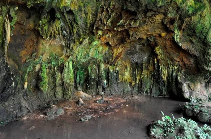
The name alone is enough to spark curiosity. Amabere Ga Nyina Mwiru translates from the Rutooro language as “the breasts of Nyinamwiru,” and it refers to a cave site near Fort Portal where stalactites and stalagmites hang and rise in shapes that unmistakably resemble human breasts. During the rainy season, mineral-rich water drips from these formations, leaving behind a milky-white trail that locals have long believed to be breast milk. It is a place where geology and mythology are so deeply intertwined that it is impossible to separate them. And that is precisely what makes it one of the most fascinating cultural and natural sites in Uganda. Where Is Amabere Ga Nyina Mwiru? The site is located approximately 7 to 10 kilometres from Fort Portal town in the Nyakasura area of Kabarole District, Western Uganda. It sits along the Bundibugyo–Fort Portal Road, at the foothills of the Rwenzori Mountains, surrounded by streams, waterfalls, crater lakes, and lush green hills. The caves are found on private property belonging to the Rubombora family, and the site is currently used for tourism as well as traditional and cultural purposes. It is well-preserved and managed by local guides who have cared for the site through generations. GPS Coordinates: 36N 191103/74930, altitude 1,558 metres The Legend of Nyinamwiru A Prophecy, a Cruel King, and a Daughter’s Fate The story of Amabere Ga Nyina Mwiru is one of the most enduring legends in the Tooro Kingdom. It begins with a prophecy that would change the fate of a kingdom. According to oral tradition, King Bukuku of the ancient Batembuzi dynasty was warned by diviners that his beautiful daughter, Nyinamwiru, would one day bear a son who would kill him and take his throne. The king, determined to thwart the prophecy, took drastic measures. Some versions of the legend say he cut off his daughter’s breasts and had them thrown into a cave, hoping to deform her so that no man would want to marry her. He then confined her in the caves. Other versions say Nyinamwiru fled to the caves in protest after her father refused to allow her to marry a man of her choosing. What King Bukuku did not know was that his daughter was already pregnant. She gave birth to a son named Ndahura — the child of prophecy. The Milky Drips and the Hidden Child The king made a second attempt to avert the prophecy by ordering the child to be killed. But the people tasked with the execution could not bring themselves to do it. Instead, they left the infant in the caves where his mother’s breasts had been discarded. According to local belief, the stalactites that drip milky water are Nyinamwiru’s breasts, still producing milk for her abandoned child. The “Amabere” (breasts) are said to have dripped milk for her abandoned son, sustaining him until he was old enough to be taken to Buganda for safekeeping. The Prophecy Fulfilled Ndahura grew up in hiding, eventually returning to Tooro as a strong young man. One day, while grazing cattle on his grandfather’s pasture, he was confronted by King Bukuku. The king, enraged, hurled a spear at him — but missed. Ndahura picked up the spear, flexed his muscles, and threw it back, killing King Bukuku and taking over the leadership of Tooro. Ndahura became the first of the Great Chwezi kings, and his story is considered by the Tooro people as the origin of their kingdom. The Shape of the Stones Visitors to the caves are shown the different breast-like formations, each with its own significance. There are stones shaped like a woman’s breasts, another pair shaped like a cow udder — allegedly symbolising Bihogo, the king’s most beloved cow — and another set of rocks that look like the udder of a dog, symbolising the dogs that used to protect the cattle of the Bachwezi. The Science Behind the Legend Stalactites and Stalagmites Geologically, the “breasts” of Nyinamwiru are stalactites and stalagmites — mineral formations created by the slow deposition of calcium carbonate from dripping water. The stalactites hang from the ceiling of the caves, while the stalagmites rise from the floor. The stalagmites grow approximately one inch per year, and when a stalactite and a stalagmite eventually join, they form a solid rock pillar that supports the cave roof. The process works like this: rainwater absorbs carbon dioxide from the atmosphere as it falls, becoming slightly acidic. This acidic water seeps through the porous volcanic rock, dissolving minerals along the way. When the mineral-rich water reaches the cave ceiling and drips, the carbon dioxide evaporates, leaving behind calcium carbonate — the white, chalky deposit that builds into the formations over thousands of years. A Geological Rarity What makes the Amabere caves unique in Uganda is the rock in which they formed. Most stalactite caves form in limestone or marble. But the Amabere caves formed in carbonatitic lavas and tuffs — volcanic rock, not sedimentary limestone. The site has three major caves, the largest about 11–22 metres long, 7 metres high, and 4–6 metres deep. The formations occur in a scenic environment that includes a waterfall, crater lakes, and hiking trails, making the site a complete natural and cultural destination. The Waterfall and the Microclimate The Nyakasura Waterfall cascades directly over the cave entrance, creating a humid microclimate that supports thick moss and ferns around the rock face. This constant moisture accelerates the growth of the stalactites, which is why the formations are so large and well-developed at this site. The water that feeds the falls comes from two sources: the Kamutebi swamp in the neighbourhood of the caves, and glacial water from the Rwenzori ranges. Visitors can stand behind the curtain of the waterfall to view the hanging stalactites through the falling water — a perspective that is both visually stunning and genuinely unique. Cultural Significance: More Than a Tourist Site A Living Cultural Symbol For the Tooro people, Amabere Ga Nyina Mwiru is not simply a geological curiosity. It is a living cultural symbol — a shrine to their ancestral origins and a place of deep spiritual significance. Local guides, often from families who have cared for the site through generations, share the legend and its variations, the cultural meaning behind the formations, and stories about the Batembuzi dynasty — believed to be the ancestors of the present-day Tooro
Garama Cave: The Sacred Underground Site of the Batwa
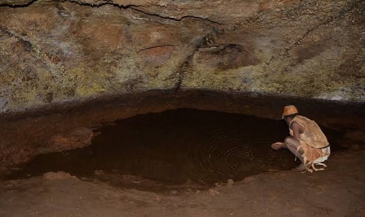
The Batwa people, the forest’s first inhabitants, believed this cave was a place of refuge, royalty, and ritual. Today, Garama Cave offers a rare and emotional journey into their lost world. 🦇 What is Garama Cave? Garama Cave is a 342-metre-long lava tube that lies 14 metres deep beneath a plateau on the northern edge of Mgahinga Gorilla National Park. Situated at an altitude of 2,300 metres on the slopes of the Virunga volcanoes, it is located just 3 kilometres from the park’s Ntebeko headquarters. For centuries, this cave was far more than a geological formation; it was the heart of the Batwa kingdom. 👑 The Cave as a Royal Capital Long before it became a tourist attraction, Garama Cave served as the headquarters of the powerful Batwa kingdom, which collapsed about a century ago under the reign of the last king, Mwami Kishegye. The cave was a multi-purpose facility, acting as: A Royal Residence: It housed the king’s throne, his bedroom, and the quarters for his wives. A Council Chamber: It was the site for important meetings and a court of justice where community conflicts were settled. A Strategic Refuge: The Batwa used the cave as a hideout and a security post against invaders, launching expeditions and retreating there for protection. A Sacred Site: Ceremonies were conducted here, making it a sacred ground. The cave was divided into specific sections, including a meeting area, an armoury, a food store, a kitchen, and a drinking and cooking water point that still exists today. Its entrance was guarded by soldiers. 🤝 The Batwa Cultural Trail The best way to experience Garama Cave is by joining the Batwa Cultural Trail, a 4-5 hour guided experience that offers a profound glimpse into the lost culture of the Batwa people. The trail is led by trained Batwa guides who share their ancestral knowledge of the forest. As you walk, they demonstrate traditional skills such as: Hunting techniques and archery. Harvesting wild honey and medicinal herbs. Making fire and constructing bamboo cups. The emotional climax of the trail is the descent into Garama Cave. Here, the guides explain its historical significance, and the women of the community often perform traditional songs and dances that echo hauntingly off the cave walls, offering a deep, moving connection to the Batwa’s past. 💡 Practical Information for Your Visit Location: Mgahinga Gorilla National Park, Kisoro District, southwestern Uganda. Cost: The Batwa Trail experience costs USD $80 per person for foreign non-residents, which includes the activity fee, a Batwa guide, park entry, and the cultural performance. Duration: The guided hike typically takes 4 to 5 hours. What to Bring: A torch or headlamp is essential for exploring the dark interior of the cave. Sturdy hiking boots, water, and a rain jacket are also recommended. Best Time to Visit: The dry seasons (June-August and December-February) offer the most comfortable hiking conditions. 💎 The Verdict: A Journey Through Time Garama Cave is not just a geological curiosity; it is a living monument to a lost kingdom and a resilient people. The Batwa Cultural Trail, particularly the descent into the cave, offers an experience that is both educational and deeply moving. It is a chance to see the forest through the eyes of its first inhabitants and to support a community that has faced immense challenges. The songs that echo off the cave walls are a poignant reminder of the rich culture that still fights to survive. Ready to step into the lost world of the Batwa? Contact TravelGiantUganda.com to plan your visit to Mgahinga and include this unforgettable cultural experience in your itinerary.
